


Hanging hardware will be included with your map to ensure you have all the pieces to install once you receive your order!
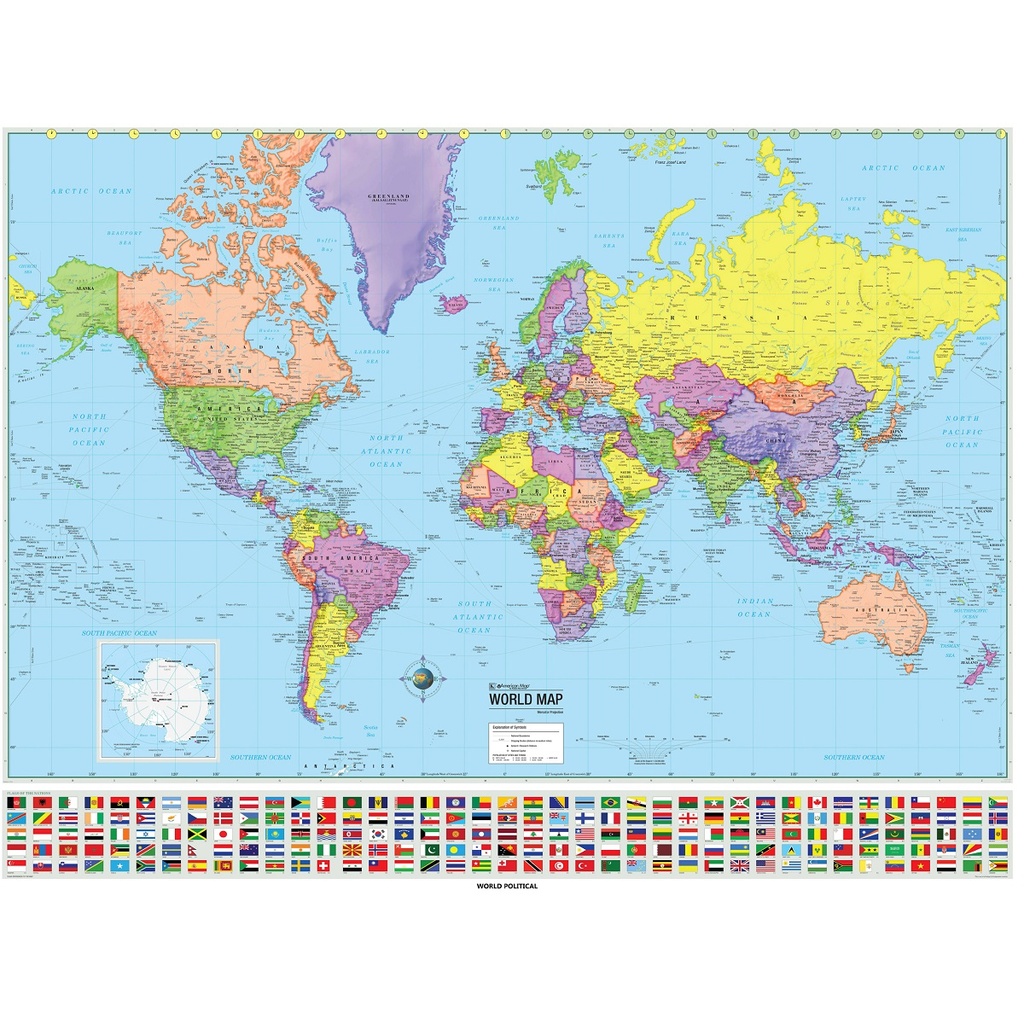
The Advanced Political Wall Map series by Kappa Map Group is an exceptional educational resource, providing a comprehensive exploration of global political landscapes. These maps feature vibrant color-coded countries, ensuring clear identification of political boundaries. Moreover, the series offers a wealth of information through four thematic insets:
• Population Density
• Annual Rainfall
• Energy, Manufacturing, and Trade
• Climate
Within these maps, you'll find:
• Country Boundaries
• National capitals
• Major cities
• Latitude and longitude lines with an emphasis on major latitudes
• Various physical features
Furthermore, the inclusion of shaded relief adds depth to the representation of landscapes, making the maps not only informative but visually engaging. The Advanced Political Wall Map series is an invaluable tool for educators and students seeking a deeper understanding of global political dynamics and geography.
Size: 63" x 54" (full height)
Published: 2000